LAKE POWELL
Lake Powell is actually a Reservoir,
so-called the Lake that is a River, because there are three rivers that inflow
to the dam, from north to south, and only the Colorado River that out flows to
the south. It is located in both Arizona and Utah and encompasses 24,322,000
acre-ft of water when full (currently at only 9,862,631 acre-ft (as of Jan
2019). It is the second largest reservoir in the US, (by water capacity),
second only to Lake Meade, in Nevada, (southeast of Las Vegas) and in Mojave
County in Arizona. It was named after the one-armed Civil War-veteran turned
explorer, John Wesley Powell. The views from the Wahweap Overlook are
breath-taking and a place not to be missed from where one can appreciate its immensity
(see aerial view photo).
LAKE POWELL NATIONAL GOLF COURSE
Nestled
against a high mesa that can be seen from miles away when approaching Page,
this 18-hole course has been given a four star rating by Golf Digest. From the
front nine to back nine, the elevation rises 300 feet. The fairways are manicured
and a deep lush green and the rough is not too expansive but thereafter
anywhere off the rough and into the desert, it is Out of Bounds. The club store
features a covered veranda and grille with a casual atmosphere and fine food at
affordable prices. However, we did not play golf there.
GRAND STAIRCASE ESCALANTE NATIONAL MONUMENT
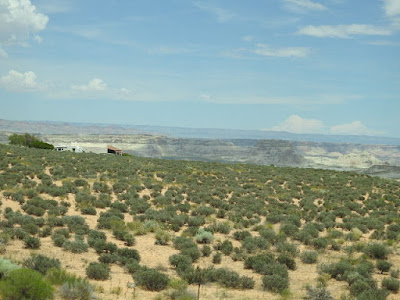
Designated a monument in 1996, the Grand Staircase Escalante National Monument embraces a sequence of cliffs and plateaus that rise 5,500 vertical feet from the Colorado River in Arizona to Bryce Canyon national Park in Southern Utah. Four Visitor Centers can be found in the Monument at Kanab, Big Water, Escalante, and Cannonville. Each Visitor Center features a different monument theme. This monument is the world center for dinosaur finds. In 2007 alone, two new horned dinosaur species, a giant crocodile, and a crested hadrosaur were discovered. Remarkably, skin, soft tissue, muscle, and tendon impressions were discovered along with fossilized bones. The sprawling 1.9 million acre monument hosts many scenic roads and recreational activities; including horseback riding, mountain biking, backpacking, camping, hunting, and fishing. Nearly 10,000 miles of roads and trails are open to all terrain vehicles. The scenic Cotton Wood Canyon road goes through the Grand Staircase-Escalante National Monument for 46 miles from Cannonville to highway 89. This back road is amazing by itself and also gets you to the great hikes like Grosvenor Arch, the Cotton Woods Narrows, and Hackberry Canyon. This sprawling preserve was the last place to be mapped in the continental United States, a suggestion of its remoteness that along with the accompanying solitude and tranquility remain its main characteristics today.


VERMILION
CLIFFS NATIONAL MONUMENT
The
Vermillion Cliffs rise from 3,100 feet in elevation to over 6,500 feet, and
provide a prominent towering backdrop to the Lake Powell area and can be seen
in the distance as far as Winslow, Arizona. At Lee’s Ferry, the cliffs are
spectacular, displaying a bright blush-red hue. The
294,000 acres of the Vermilion Cliffs National Monument span Northern Arizona
and Southern Utah. The 38 mile long Paria River runs through a 2500 foot
deep Navajo sandstone slot canyon formed from ancient sand dunes that calcified
into rock.
Some
other attractions worthy of exploring, which we left for another trip are:
ANTELOPE CANYON
Run
by Navajo Nation Parks and Recreation, the slot canyons at Antelope Point as
well as Waterholes and Rainbow Bridge trail attract millions of visitors every
year. Tours to the Antelope slot canyons are provided by several
Navajo-run enterprises in the City of Page as well as the Parking Lot entrances
to the canyons.
ANTELOPE POINT MARINA
Built
within the boundaries of both the Navajo Nation and the Glen Canyon National
Recreation Area, Antelope Point Marina is part of the Navajo Nation’s Parks and
Recreation Department. Full Service Marina with Restaurants, Boat Rentals,
and Tours available.
COYOTE BUTTES
Coyote
Buttes is part of the Vermillion Cliffs National Monument, in the Paria Canyon
Wilderness Area. The Coyote Buttes Area is managed by the Bureau of Land
Management and permits are required. Stop by the Paria Contact Station
before beginning your hike. Personnel at the Contact Station will have the
latest information on road and hiking conditions in Coyote Buttes. Please view
the rules and regulations for the Coyote Buttes area. Walk-in
permits to Coyote Buttes are available at the Grand Staircase-Escalante
National Monument Visitor Center in Kanab, Utah, the day before you wish to
hike. Coyote Buttes’ outstanding scenery, desert wildlife, colorful
history, and opportunities for primitive recreation will remain free from the
influence of man and are protected in this condition for future generations.
Its 112,500 acres beckon adventurers who yearn for solitude, scenic splendor,
and the chance to explore one of the most beautiful geologic formations in the
world, created by Congress in 1984.
THE WAVE AT COYOTE BUTTES
In
1984 Congress created the Paria Canyon – Vermilion Cliffs Wilderness
area. The Wave at Coyote Butte is a popular landmark requiring a lottery
system to get permits for entry by the Bureau of Land Management. The
colorful swirls of cross-bedded sandstone in Coyote Buttes are an international
hiking destination. Permits to hike to The Wave at Paria Canyon are required by
the Bureau of Land Management in advance by a lottery system. Wiregrass
Canyon near Big Water, Utah, is a six mile hike through a sandy wash. Some
scrambling around rocks is necessary. For hardy, experienced hikers, Paria Canyon is a
90-mile round trip hike with multiple river crossings.
BUCKSKIN
GULCH is the longest continuous slot canyon
in the country. It offers a variety of day and overnight hiking options. Many
hikers will start their trip at the Wire Pass Trailhead, enter Buckskin Gulch
after 1.7 miles and travel either up or down canyon. There are multiple 4-9
foot tall moderate obstacles requiring scrambling up and down boulder.
We made it to the entrance of the trailhead but did not venture into the trail
on this occasion, saving it for another visit.
LEE’S
FERRY
Lee’s
Ferry is only one of seven available crossing of the Colorado River for 750
miles. Considered the beginning of the Grand Canyon, Lee’s Ferry serves
as the primary launch point for Grand Canyon river trips. Located at the
intersection of the Echo and Vermillion Cliffs, Lee’s Ferry is praised as one
of the most beautiful locations on the Colorado River. However, fortunately we
did not take a river raft cruise.
NAVAJO PARKS AND RECREATION
Navajo
Parks and Recreation oversee the Upper and Lower Antelope Canyon, Upper and
Lower part of the East Waterholes, as well as the Rainbow Bridge trail.
Permits must be obtained to enter these areas and guided tours are required to
visit the Antelope Slot Canyons. We did not make it here either.
NORTH
RIM OF THE GRAND CANYON
Nestled
inside of the Kaibab National Forest, the North Rim is over 1,000 feet higher
than the South Rim, at an elevation of 8,000 feet. A winding road takes
visitors through Ponderosa pine, quaking aspen, and gamble oak trees. The North
Rim features a lodge and dining facilities in addition to camping sites along
the edge of the canyon. Nearby trails provide easy access to additional trails,
and permits are required for camping below the rim. The Forest Service Visitor
Center is located at the nearby community of Jacob Lake. Because of heavy
snowfall, the North Rim closes from October to mid-May. The most
spectacular rafting in the world can be found traversing down the mighty
Colorado river.
RAINBOW BRIDGE
Rainbow
Bridge National Monument is the most famous site on Lake Powell. Rainbow Bridge
is often described as the world’s highest natural bridge. The span of Rainbow
Bridge 234 feet (71 m). At the top it is 42 feet (13 m) thick
and 33 feet (10 m) wide. There are two ways
to get to the Rainbow Bridge National Monument… use a private, rental, or tour
boat OR backpack across Navajo Tribal land. By water Rainbow Bridge can
be reached by a two-hour boat ride on Lake Powell from either of two marinas
near Page, Arizona, followed by a short mile-long walk from the National Park
wharf in Bridge Canyon; or by land, hiking several hours overland from a
trailhead on the south side of Lake Powell. If we come back to see this
attraction, Bill’s vote is to take the boat ride.
Hiking on Navajo Land requires a
permit purchased in advance. Read the Navajo Nation Regulations about
traveling on Navajo Land here. In the Lake Powell area, you can purchase
a permit next to the LeChee Chapter House, which is 3 miles south of Page,
Arizona on Coppermine Road (Navajo Route 20).
* * * * * * * *
 The
Horseshoe Bend overlook provides an awe-inspiring view of the Colorado river
meandering on its way to the Grand Canyon. Horseshoe Bend is located about 5
miles south (downstream) from the Glen Canyon Dam on Highway 89. Look for the
small “Horseshoe Bend Overlook” sign along the highway. We
decided to go early in the morning to avoid the big crowds and busloads of
tourists, so we arrived at 7:50am and were thankful for a good decision. The
parking lot was only about ¼ full, compared to about 2/3 full just an hour
later. We deliberated whether to take Roxy with us, due to the heat and crowds,
but ultimately decided t take her because she is after all a part of ‘us’ and
we wanted to include her in the photos on the blog. OMG!! That was the best
decision. She absolutely loved going with us and stood out as an Ambassador of
Goodwill, among all the Korean, Chinese, German, Indian and British tourists
there. She has never been petted, adored and photographed by so many people,
internationally… and she seems to love it. Every time we stopped to give her water,
somebody would come and ask to take a picture with her; then someone else and
then someone else, to the point t hat soon there would be a crowd of mostly
young girls petting her. She absolutely loved it. Mary calls her ‘”our
Instagram model”.
The
Horseshoe Bend overlook provides an awe-inspiring view of the Colorado river
meandering on its way to the Grand Canyon. Horseshoe Bend is located about 5
miles south (downstream) from the Glen Canyon Dam on Highway 89. Look for the
small “Horseshoe Bend Overlook” sign along the highway. We
decided to go early in the morning to avoid the big crowds and busloads of
tourists, so we arrived at 7:50am and were thankful for a good decision. The
parking lot was only about ¼ full, compared to about 2/3 full just an hour
later. We deliberated whether to take Roxy with us, due to the heat and crowds,
but ultimately decided t take her because she is after all a part of ‘us’ and
we wanted to include her in the photos on the blog. OMG!! That was the best
decision. She absolutely loved going with us and stood out as an Ambassador of
Goodwill, among all the Korean, Chinese, German, Indian and British tourists
there. She has never been petted, adored and photographed by so many people,
internationally… and she seems to love it. Every time we stopped to give her water,
somebody would come and ask to take a picture with her; then someone else and
then someone else, to the point t hat soon there would be a crowd of mostly
young girls petting her. She absolutely loved it. Mary calls her ‘”our
Instagram model”.


